Climbs
12 prints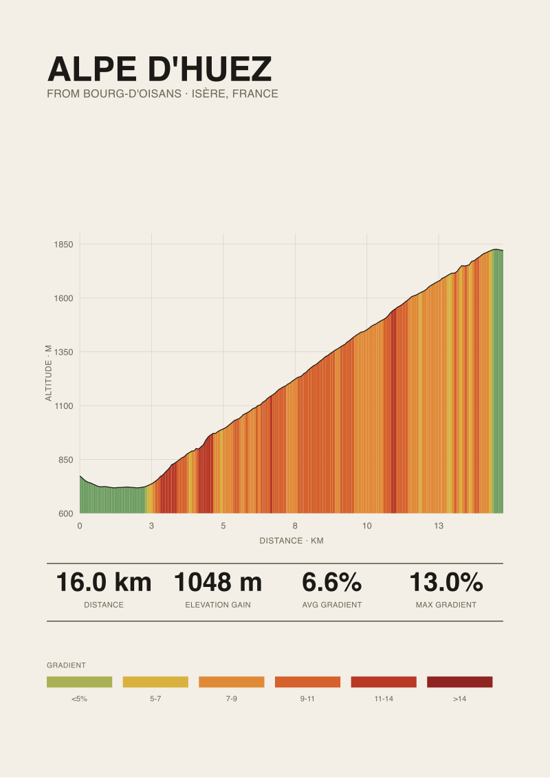
Alpe d'Huez
Twenty-one numbered hairpins above Bourg-d'Oisans, the most famous finish in cycling. Drawn from the real road: 16.0 km climbing 1048 m at 6.6% average, 13.0% at its steepest. Elevation measured along the ascent, not drawn by hand.
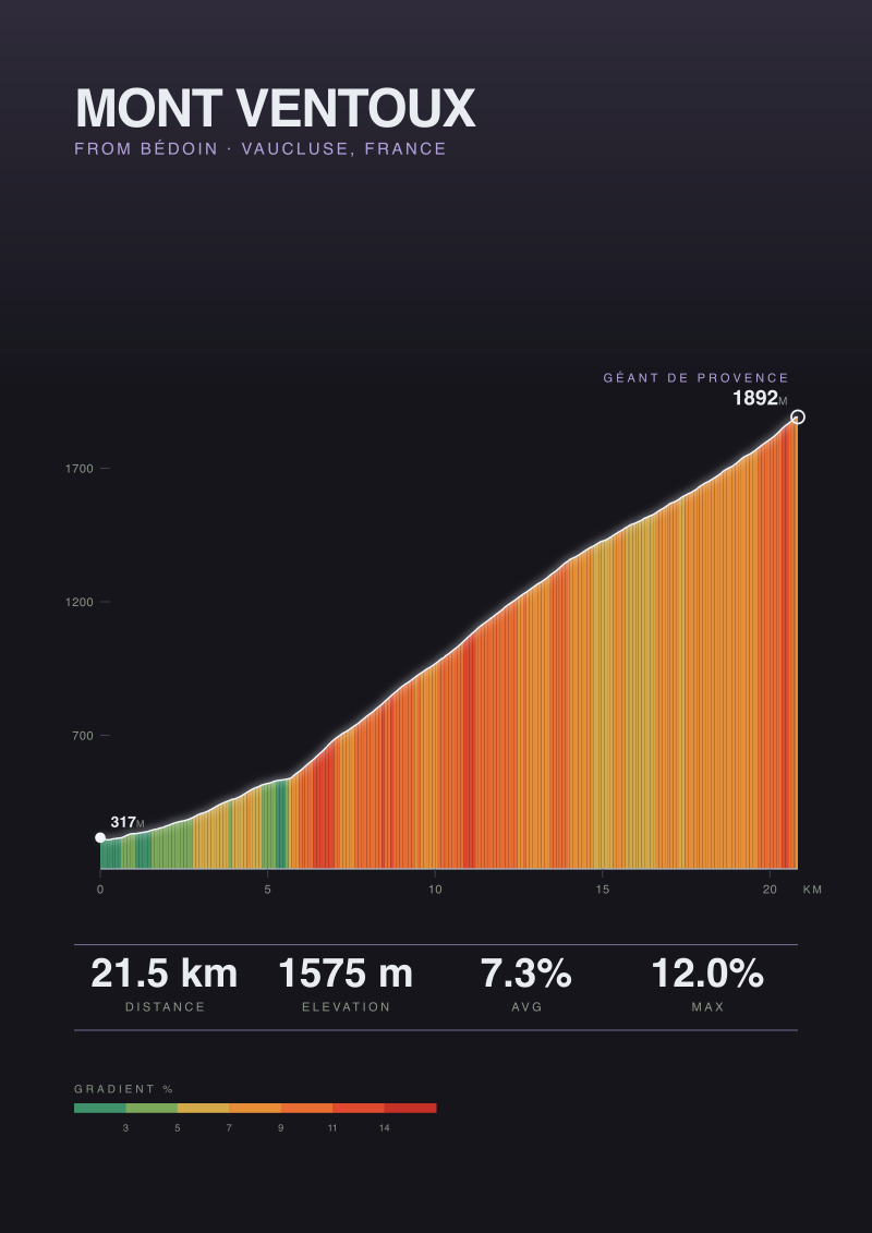
Mont Ventoux
The Giant of Provence, a bare limestone summit that stands alone over the Vaucluse. Drawn from the real road: 21.5 km climbing 1575 m at 7.3% average, 12.0% at its steepest. Elevation measured along the ascent, not drawn by hand.
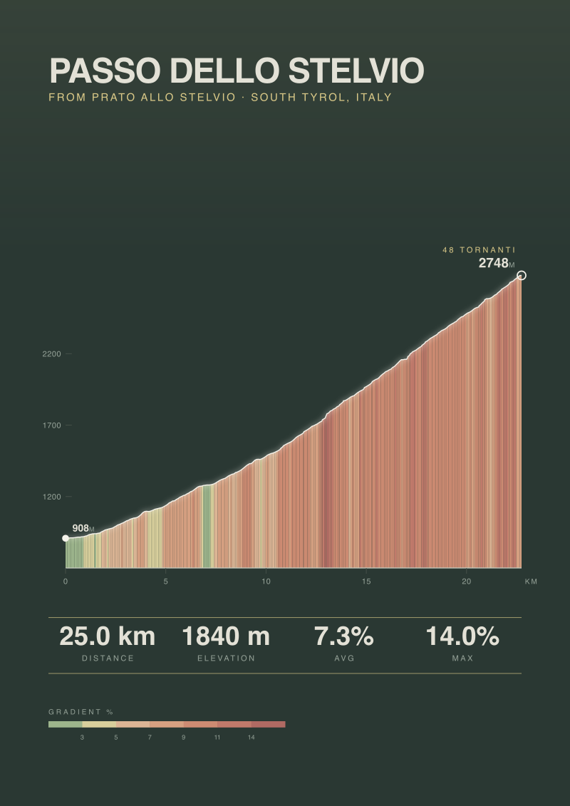
Passo dello Stelvio
Forty-eight switchbacks stacked against the Ortler, the roof road of the eastern Alps. Drawn from the real road: 25.0 km climbing 1840 m at 7.3% average, 14.0% at its steepest. Elevation measured along the ascent, not drawn by hand.
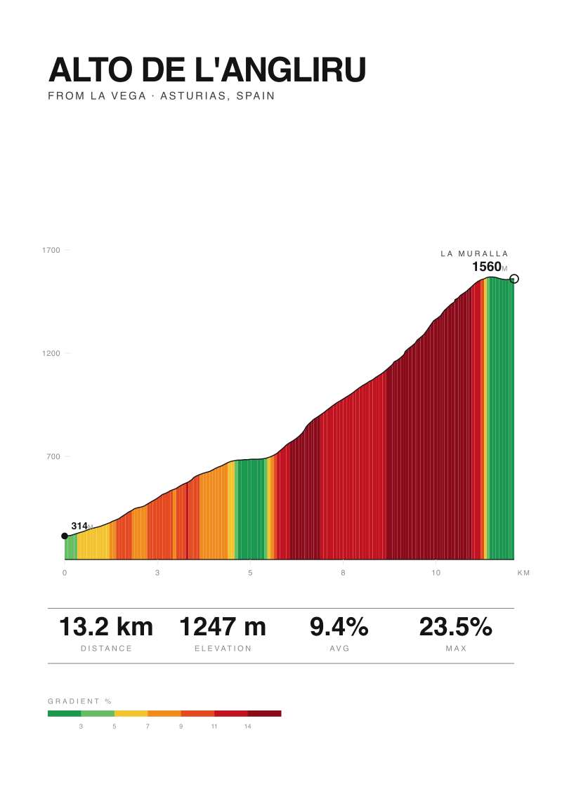
Alto de l'Angliru
Asturian brute of the Vuelta, ramps past 20% on a wall through the fog. Drawn from the real road: 13.2 km climbing 1247 m at 9.4% average, 23.5% at its steepest. Elevation measured along the ascent, not drawn by hand.
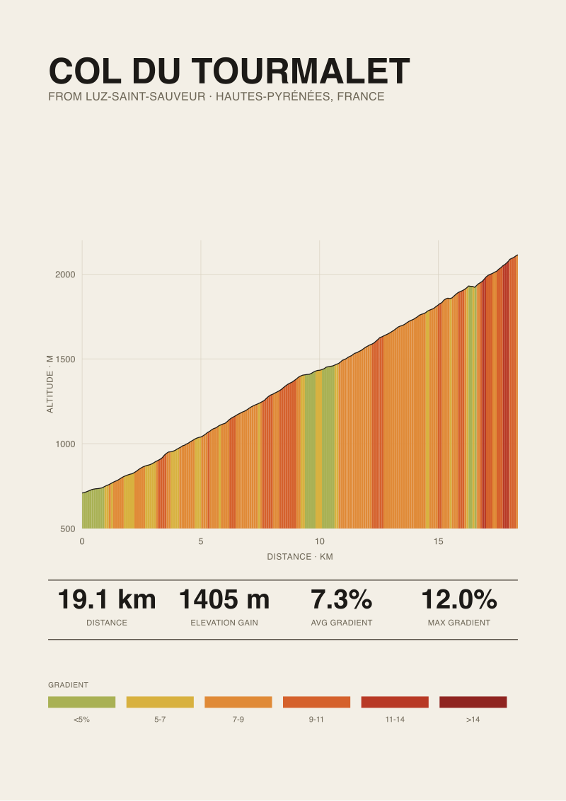
Col du Tourmalet
The Pyrenean giant, more Tour summits than any other pass. Drawn from the real road: 19.1 km climbing 1405 m at 7.3% average, 12.0% at its steepest. Elevation measured along the ascent, not drawn by hand.
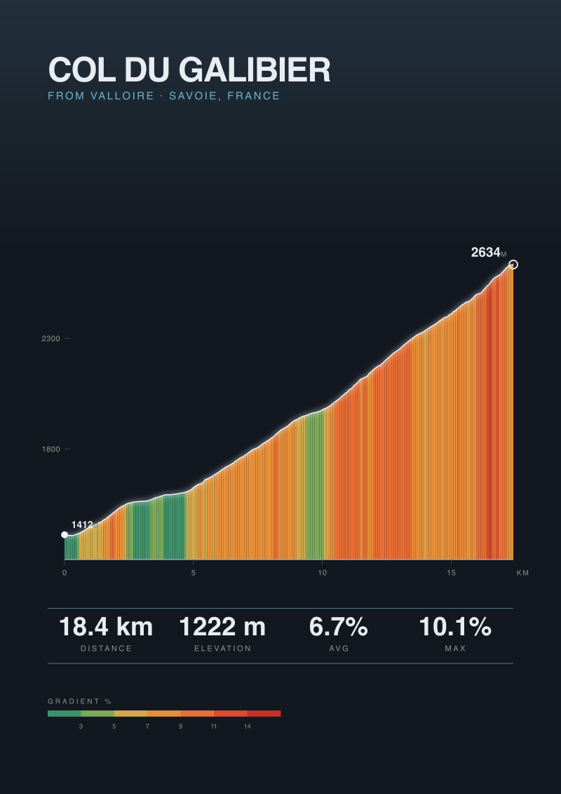
Col du Galibier
High Savoyard col linking the Tour's great valleys, thin air above 2600m. Drawn from the real road: 18.4 km climbing 1222 m at 6.7% average, 10.1% at its steepest. Elevation measured along the ascent, not drawn by hand.
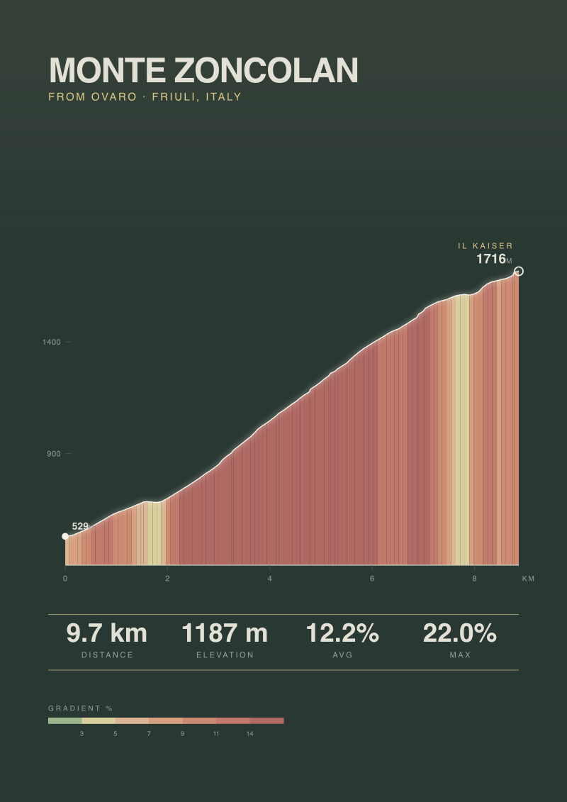
Monte Zoncolan
The Kaiser, cycling's steepest sustained climb, a relentless wall from Ovaro. Drawn from the real road: 9.7 km climbing 1187 m at 12.2% average, 22.0% at its steepest. Elevation measured along the ascent, not drawn by hand.
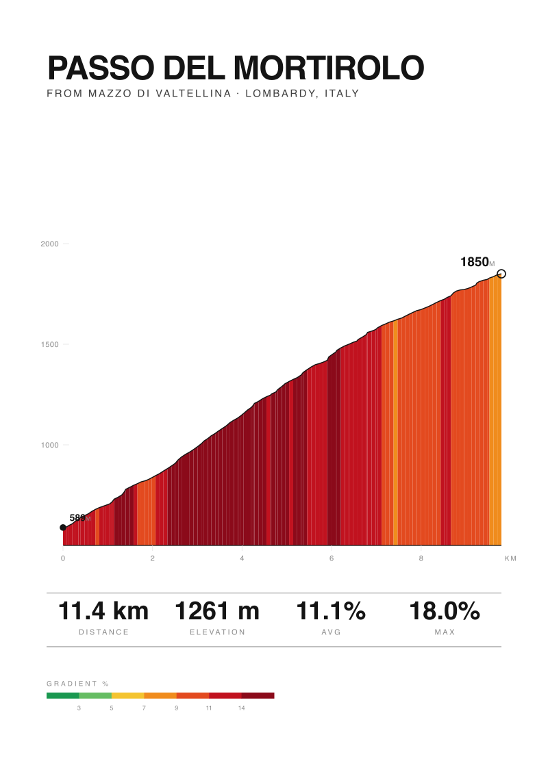
Passo del Mortirolo
A narrow farm road out of Mazzo that became the hardest test of the Giro. Drawn from the real road: 11.4 km climbing 1261 m at 11.1% average, 18.0% at its steepest. Elevation measured along the ascent, not drawn by hand.
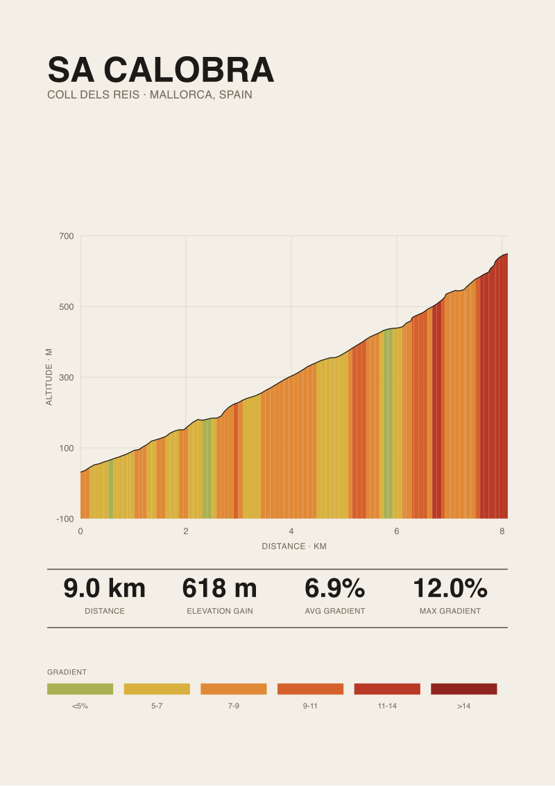
Sa Calobra
A road that ties itself in a knot down to the Mallorcan coast, then climbs back. Drawn from the real road: 9.0 km climbing 618 m at 6.9% average, 12.0% at its steepest. Elevation measured along the ascent, not drawn by hand.
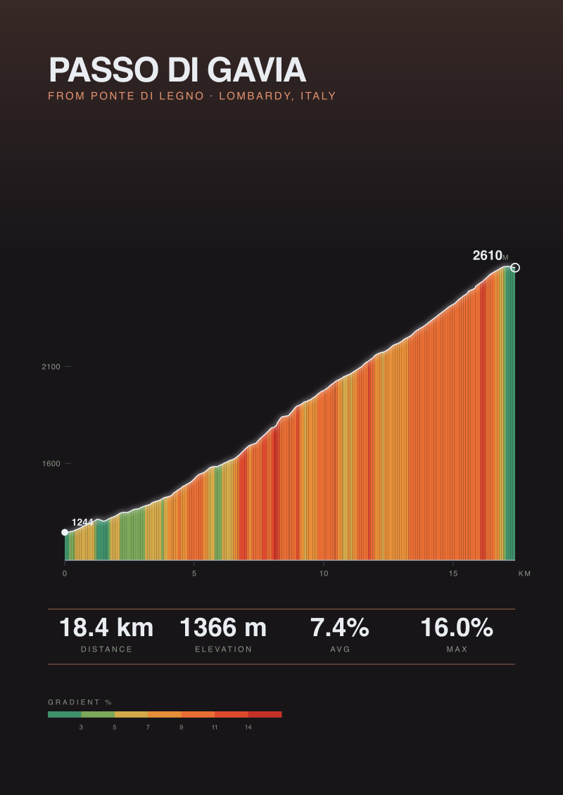
Passo di Gavia
A wild, high Lombardy pass, unpaved in memory, unforgiving still. Drawn from the real road: 18.4 km climbing 1366 m at 7.4% average, 16.0% at its steepest. Elevation measured along the ascent, not drawn by hand.
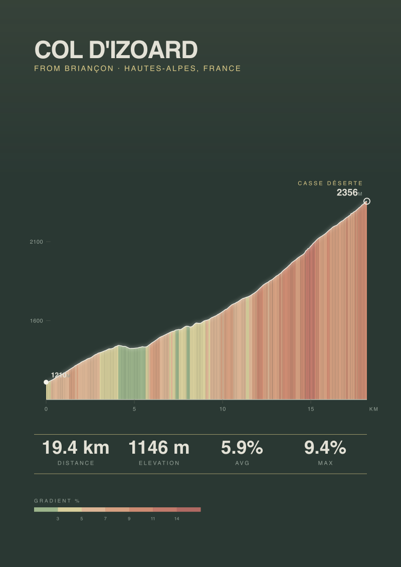
Col d'Izoard
Through the lunar Casse Déserte above Briançon, an Alpine rite of passage. Drawn from the real road: 19.4 km climbing 1146 m at 5.9% average, 9.4% at its steepest. Elevation measured along the ascent, not drawn by hand.
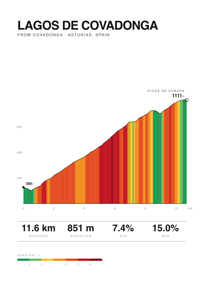
Lagos de Covadonga
Up to the glacial lakes of the Picos de Europa, the Vuelta's northern shrine. Drawn from the real road: 11.6 km climbing 851 m at 7.4% average, 15.0% at its steepest. Elevation measured along the ascent, not drawn by hand.
Cycling Patents
4 prints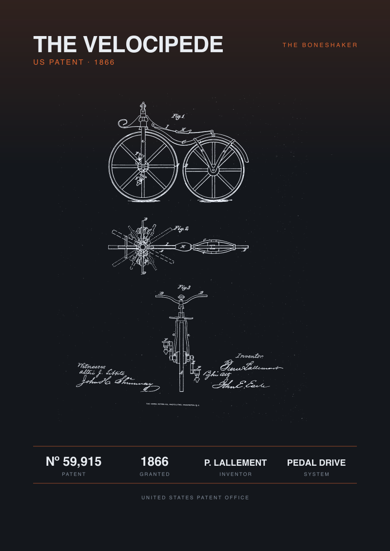
The Velocipede Patent, 1866
United States Patent Nº 59,915, granted 1866. The drawing shows a pedal driven velocipede across three figures: a side elevation, the front wheel crank and pedal, and a front view with the sprung saddle. The first United States bicycle patent. Reproduction of a public domain patent document.
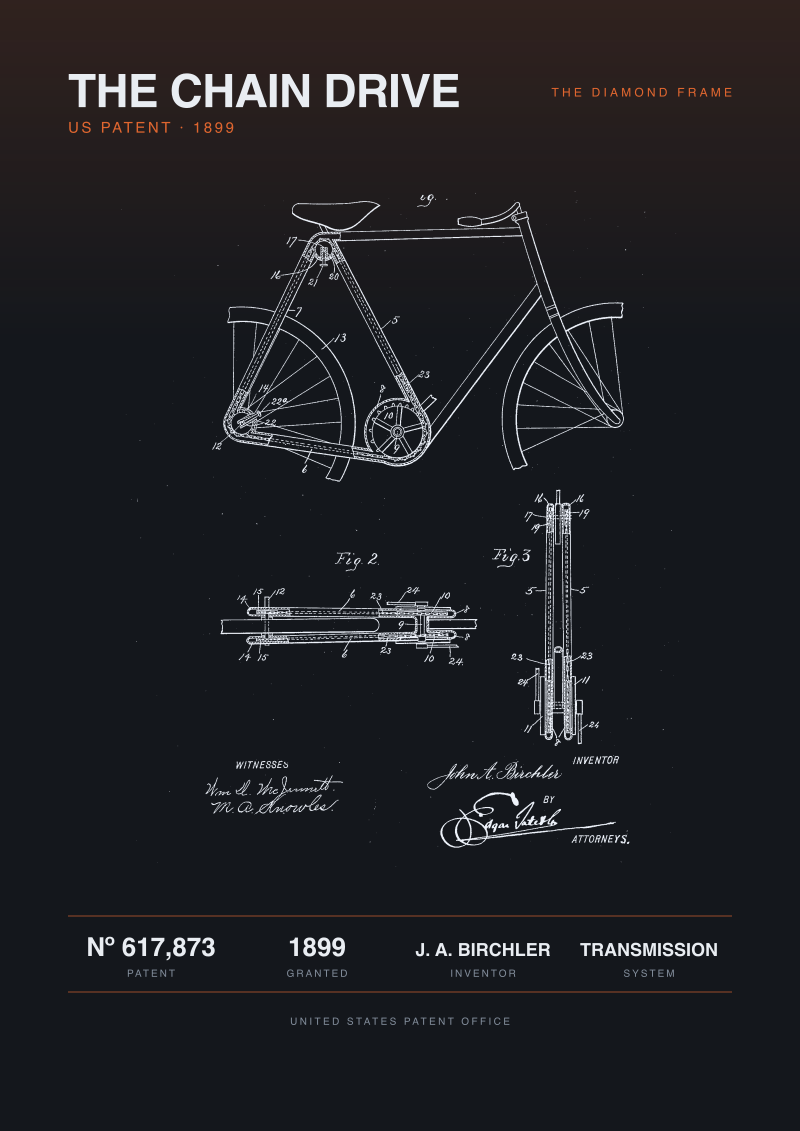
The Chain Drive Patent, 1899
United States Patent Nº 617,873, granted 1899. The drawing shows a diamond frame safety bicycle and, in its detail figures, the enclosed chain mechanism that drives the rear wheel. Reproduction of a public domain patent document.
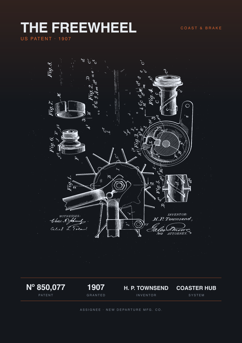
The Freewheel Patent, 1907
United States Patent Nº 850,077, granted 1907. The drawing is an exploded view of a rear hub that combines a driving clutch, a coasting freewheel and a coaster brake arm, across several figures. Reproduction of a public domain patent document.
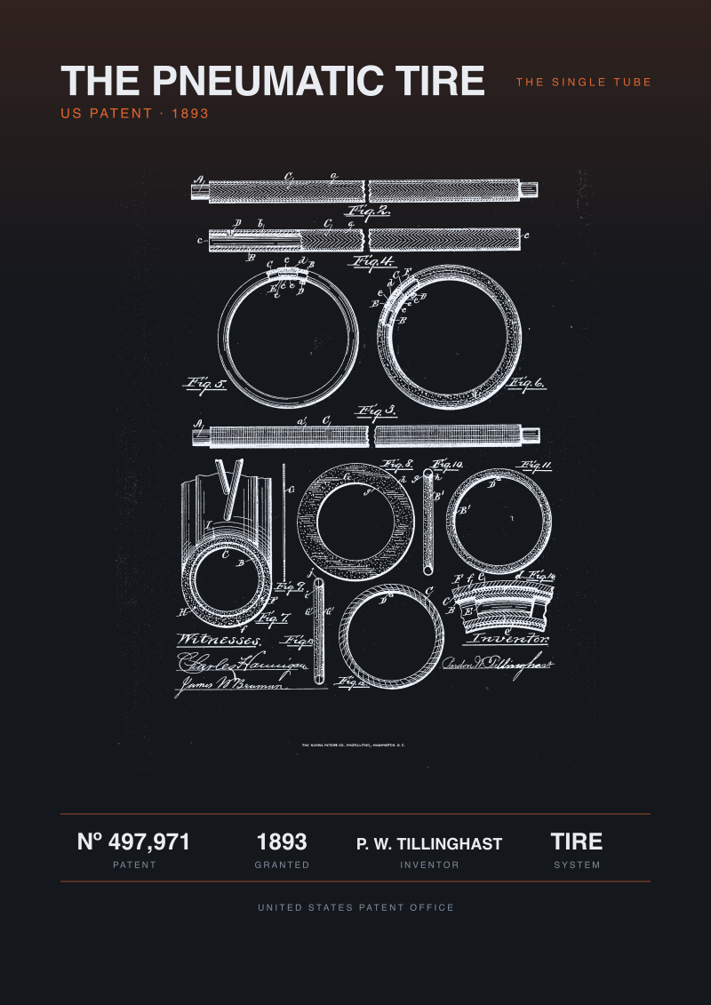
The Pneumatic Tire Patent, 1893
United States Patent Nº 497,971, granted 1893. The drawing shows a single tube pneumatic tire in fourteen figures: the casing rings, the inflation valve tube and cross sections through the tread. Reproduction of a public domain patent document.